Thursday 30 May 2013

St. Kilda


St. Kilda is a tiny remote island group that bears the brunt of ugly North Atlantic weather at a lonely spot some 50 miles to the west of the Outer Hebrides. The only landing place in the group is on Hirta in a bay that is wide open to the southeast.

During our stay at Loch Skipport, we had been checking daily for a long enough period of settled [but not southeast] weather to visit Hirta. As is often the case, when we had finally given up and decided to head for Stornoway and park ourselves for a week of two in "the big city", the break finally came.

Hirta can rarely be visited by small boat in the summer and even less frequently in the winter. Surprisingly though, it was inhabited by extraordinarily hardy folk for at least 4000 years until they decided to leave the island in 1930. The people were essentially self sufficient, living mostly from the exceptionally large seabird colonies that inhabit the island group. They ate seabirds and seabird eggs, dried seabirds for winter in a type of stone drying cairn and harvested wool from the wild sheep to weave and knit clothing. The 'owner' of the islands lived on the Isle of Skye and collected rent in the form of feathers and seabird oil.

There is still a human presence on the island in the form of Scottish National Trust caretakers, research anthropologists and the folk running a small radar site on top of the highest hill. Nonetheless, the intact abandoned stone houses, drying mounds and fences, and innumerable roaming wild Soay sheep [looking like tiny llamas] give the impression of a Scottish Macchu Picchu.

You, the reader, can glean far more information by googling St. Kilda than I can provide from our rolly anchorage here in Village Bay but, as always, the impressions gleaned by being here have an immediacy not available from an armchair.

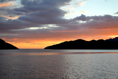
The long trip out here under sail when coupled with a bit of imagination regarding vessels available in centuries past gives a feeling for the isolation experienced by the inhabitants long ago. We arrived at 2 am with the nearby rocky island of Boreray offering a stunning silhouette against the northern midnight twilight. In the morning, the leftover swell from the previous days of heavy weather led to some effort being required to move the dinghy from deck to water. Finally though, we were able to walk through the eerie remains of the village.

By this time, a few tourist boats had arrived, the first after many days of inclement weather. The tourists, like ourselves, had to go ashore in small inflatable dinghies. No large covered boats are allowed at the pier to prevent the introduction of alien species [rats, for instance] to the island. The sheer scale of the village area easily absorbed the small number of tourists without their seeming to have any effect on the visual scene. The day was perfect with bright sunshine and little wind.

During the evening, we and a group of Scots paid reciprocal visits to each other's boats. In brief, this involved some drinks, some cake, some bagpipe, some piano and some song.

We decided that on our second day we would climb to the hilltops that surround Village Bay for a view from above, a look into the other [larger] valley on the island and a vista of the other islands and sea stacks in the St. Kilda group. It was promised that the obscuring mist would burn off shortly under the heat of the sun.

As you no doubt fear from the preceding paragraph, the mist failed to dissipate and from an elevation of 350 meters [1150 feet] we had a view only of the grass at our feet and a surrounding white 'wall'. We waited a considerable time in the damp mist and, slightly disappointed, headed back toward the village. Half way down the hill the mist cleared to present the highlands in bright sunshine. More stalwart folks than us would have reversed course and marched back up to the hilltops ...


-----
At 30/05/2013 17:29 (utc) our position was 57°48.53'N 008°33.94'W

Friday 24 May 2013

Dive at Little Kettle Pool

Yesterday, after unrelieved ugly weather for several days, we decided to "get wet" … Diving never fails to lift our spirits. The contrast between the grey, cloudy, windy stormy weather and the beautiful colours and marine animals under the surface is guaranteed to change your mood.
Actually, the dive was not all that spectacular as dives go. We wear dry suits which keep our bodies warm in this cold water. Only our heads and hands get wet.

We found all surfaces were covered in a full layer of sediment - something we're quite used to from diving in Howe Sound near Vancouver. Whenever we mistakenly touched the leaves of the kelp forest, huge clouds of sediment rose around us. We were only 15 feet deep so it's very hard to maintain a proper distance from things as you breathe in and out - one deep breath can take you to the surface instantly. I tried to lean on the bottom to adjust my buoyancy. That was a mistake, as clouds of sediment rose up and I seemed prepared to go down another 20 feet in the almost-liquid mud. Luckily my buoyancy mistakes didn't bother Larry and he was still able to take a few good photos.

Once we edited our photos we were delighted with the things we had seen. Some of them are probably very ordinary to professional folks (divers and scientists) but they're new to us. We saw stars: asterias rubens, marthasterias glacialis and asterias rubens (sun stars and common stars), the protanthea simplex anemone which has apparently only recently been found in western Scotland. We saw an awful lot of tunicates - the dendrodota gossularia tunicate is an animal which can occur in densities from 50-60,000 specimens per square meter.

My favourite was the paguras bernhardus (common hermit crab) which is pictured here.
As you possibly didn't know, hermit crabs are arthropods who select the old shells of dead snails to carry around as protection. As the hermit crab grows, he has to select a series of new/dead shells which are of a more appropriate size. Mating is achieved by the male choosing a female who happens to be exchanging shells. It's thought she gets interested in him because he can protect her naked body with his shell while he's covering her.

You'll see his claws are covered in little spines … you can also see he's carrying a load of something on his back. It looks like a load of grasses. However, these are hydroids and are themselves animals (even though they look like plants). They are called hydractinia echinata. When they were larvae, they floated out from a colony of hydroids … and they actually selected this very hermit crab shell. The relationship between hydroid and crab is mutually beneficial - the hydroid gets more food flowing past because of faster movement through the water, and the crab gets protection from the stinging cells of the hydroid. Our I.D. book feels the hydroid larva can tell our crab was alive under the dead shell because snails are so VERY slow and hermit crabs are so VERY speedy!


-----
At 24/05/2013 13:48 (utc) our position was 57°19.54'N 007°14.84'W

Tuesday 21 May 2013

Loch Harport


Sunday I awoke early when a huge wave sloshed against the side of the boat - twice. I thought perhaps a dolphin or Minke whale had swum up to have a look at Traversay. By the time I got outside all signs of a visitation were gone. Sitting outside listening, I heard the sounds of a lamb high up on the Southern hills belligerently calling its mother, and the much more subtle sounds of a cuckoo. Listening longer, I heard an answering call from a bird far across on the equally high Northern hillside of the wide and lengthy inlet.

Huge winds which had kept us boat-bound all day Saturday calmed during the night, and we were now turned around completely, and facing downstream.
We went ashore in glorious sunshine to walk the length of the pretty little village backed by the mountains of Cuillin. During our wanderings we met an Old Car Club aficionado with his stable of Bentley convertibles and heard about the Club's drive through Russia, and across Australia (all in aid of a charity). We met a faith healer - John - who had lost his leg in a motorcycle accident and we met a lobster fisherman anchored near us. He comes up here and takes tourists around the Loch in summer.

On Monday we made the welcome discovery that the Talisker Distillery takes credit cards. Our last £ had been spent on chocolate, cards and stamps (there have been no banks, useful cash machines, useful internet or phone service for most of our trip so far).

There's much to be said for the ingenuity of human-kind to have come up with such a specialized and technology-intensive product as Scotch whiskey. It seems the perfect business - possibly the ONLY business - that could take root in a Scotland de-populated by the Highland Clearances of the 18th and early 19th Century. Some of the essential ingredients are freely available (thus again justifying the rest of the world's impression that the Scots are "cheap"!) It features spring water near its source, steam fired by locally-acquired peat-set fires and barley and yeast from the interior of Scotland. These flavours still permeate the final product after the numerous steps and stages of its manufacture. The only part of the process which is imported are the oak bourbon casks (from the U.S.) used for the ageing process. These are re-built after being purchased 2ndhand from the American distillers where the casks are destroyed by law after only one season (to provide employment for American cask makers!) These casks provide some of the flavour and the distinctive golden colour to the finished product. Transport of all needed items in the manufacturing process was (in times past) by sea as was the distribution of outgoing product. So all the great distilleries of Scotland are on the ocean. Most are on the Isles of Islay, Jura and Talisker on the Isle of Skye.
Landlords had found that filling the countryside with sheep was more cost-effective than a human population - so they cleared them off the land. Since many of the Cleared people came to the New World, Scotland's loss was our gain!

Single malt Scotch whiskey is an acquired taste, and a little can go a long way. We were given a taste of 10-yr-old Talisker at the end of the tour, and its warm glow and soporific effect persisted throughout the day. And yes - we bought a bottle and I got the T-shirt!

During our time at anchor the usual domestic preoccupations took up part of our time. There are the regular tasks - like endless thought and preparation of meals with diminishing stores of fresh food for me, Larry's chart-reading, weather and routing concerns … there are the quarterly jobs like cleaning all exterior stainless for me, oil changes for Larry and there are the unexpected tasks - like repairing the shorted-out wires on the generator starter. This lead to a sudden breakdown of our generator on Monday. Larry fixed it, we got the dinghy aboard, and we went to bed early so we could start for the Western Hebrides early this morning.
On our way over, we saw a number of guillemots, auks and my favourite bird - the puffin. I would like to have the personality of this bird - they seem as if they're in a permanent Scotch-induced haze. They appear lazy, they fly with ungainly wind-mill-type wing-movements, and they move slowly on the water. I raced up with my new camera to try to get a photo. They're a "canny" bird - not really lazy - at the last moment I was foiled when they dived. I have yet to get a decent photo.

Here we are in "Little Kettle Pool" - another large loch with a key-hole entrance. This will keep us safe from the heavy North winds predicted for the next few days.

Caolas Mor (Little Kettle Pool) Western Hebrides

-----
At 21/05/2013 14:14 (utc) our position was 57°19.54'N 007°14.83'W

Saturday 18 May 2013

Over the Sea to Skye


It seems every remote corner of Scotland is full of hardy tourists. At the little cafe on Rum, we met a young Aberdeen couple, both doctors, who were cycling around Scotland. One had previously cycled from Shanghai to Kathmandu! These are the sort of people who, undeterred by the lack of roads, bring their cycles on the ferry anyway just for the joy of a new adventure.

After meeting these stalwart souls over lunch along with a few errant sailors like ourselves, we started uphill until the trail steepened enough to give us a good view of the loch far below.


     "Speed bonnie boat like a bird on the wing
     Onward the sailors cry
     Carry the lad who was born to be king
     Over the sea to Skye"

It seems each island we head for has its own song like this one describing the escape of Bonnie Prince Charlie to the Isle of Skye after defeat by the English at the Battle of Culloden. Presented with dissipating showers and calming seas, we followed in Charlie's wake to cover the 12 or so miles north to Skye.

Loch Scavaig and the even tinier Loch na Cuilce are surrounded by the beautiful Cuillin Mountains on the south coast of Skye. Mary Anne's sharp eyes noticed from a great distance that the grey boulders on the myriad of rocks I was dodging in the entrance were all seals. They were all turned towards us, watching no doubt for navigational errors. The choice between the profusion of sea life on the rocks below and the kilometer high rocky peaks scraping the clouds above was a challenge to the eyes!

After negotiating the last of the rocks and turning behind an island, Traversay came to rest at anchor in a seemingly landlocked pond of still water.

We took our dinghy over to a tourist launch by the rocky shore where the skipper of the last boat of the day graciously allowed us the use of the steep steel stairway and offered to tie our dinghy to it when he left - thereby saving us a scramble over the boulder and seaweed covered low-tide beach.

Just around the corner from the sea-loch was a long fresh water loch surrounded by mountains. What a view! Afterwards, a convivial evening was spent in the company of adventurers (young and old) staying at the climbers hut just above our anchorage. Nearly all of this varied group of people had walked in 14 km from the nearest road with their week's supplies. They told stories - fascinating and frightening - of climbing not just in Scotland but everywhere from British Columbia to the Andes to the Himalaya!

So it seems here in Scotland there is a near perfect day to balance each awful one.


-----
At 17/05/2013 10:53 (utc) our position was 57°11.87'N 006°09.94'W

Tuesday 14 May 2013

Not for Beginners

We've just left Loch Drambuie and as you see, we're now anchored off Rum Island in the "Small Isles". In a day or two we'll hie us 'Over the Sea to Skye'.
We'd left a lovely sheltered spot where the two of us had gathered around the piano (can two gather?) and sung rousing songs like "Scotland the Brave". When our own voices failed us, we'd been regaled by Kenneth McKellar singing such classics as "Bluebells of Scotland" and "Roamin' in the Gloamin'"
It does sound Romantic, doesn't it? But BEWARE you lonely sailors who desire a companion to grace your travels. No matter how romantic this land of great whiskey and even-better songs may appear, you will never woo your lassie with THIS voyage! Better to start with many years of palm-tree-laden Caribbean and Pacific Isles.
Last night at 2030 (just after the latest weather report) I was interrupted in my reading with the announcement that we'd be getting up at 0330 and leaving at first light in order to finally make our way out of Loch Sunart. I was tempted to break into a chorus of "You Take the High Road". I knew discomfort ahead would be my unenviable lot. This outweighed the fact that after 6 days alone together we might talk to someone other than our spouse (no service for cells or 'net here!) We might walk on dry land and SEE the Highlands up-close.
Why were we Loch-locked for so long? The following TYPICAL weather report for this area explains:

ROCKALL, MALIN, HEBRIDES, BAILEY
CYCLONIC IN NORTH HEBRIDES AND NORTH BAILEY AT FIRST, OTHERWISE
WESTERLY OR NORTHWESTERLY 7 TO SEVERE GALE 9, OCCASIONALLY STORM 10
AT FIRST IN BAILEY. HIGH OR VERY HIGH. RAIN OR SQUALLY SHOWERS.
MODERATE OR POOR

ARDNAMURCHAN POINT TO CAPE WRATH - STRONG WINDS ARE FORECAST

24 HOUR FORECAST: WEST, VEERING NORTHWEST LATER, 6 TO GALE 8,
OCCASIONALLY SEVERE GALE 9, DECREASING 4 OR 5 LATER. VERY ROUGH OR
HIGH, OCCASIONALLY VERY HIGH FOR A TIME. RAIN OR SQUALLY SHOWERS.
GOOD, OCCASIONALLY POOR.

[THE NUMBERS ARE BEAUFORT WIND SCALE, 9 CORRESPONDING TO 40 KNOTS OR SO]

Larry explained that we had a fantastic opportunity to go forward to this comfortable haven at Rum Island. If you fancy this name (it is of Viking origin) the others in this group are the Isle of Muck and the Isle of Eigg. The weather is now sunny (but windy) and tomorrow we'll see the island. It has a Mansion-turned-hotel where we might grab a bite. The island is owned by the Scottish National Heritage and is home to many bird colonies. There are no restrictions for wandering about and taking in all the picturesque views.
My concerns about the trip turned out to be unnecessary. Not because the conditions were good - including constant assault by 2-metre high waves, pounding into head winds, pouring rain or hail and a duration of 6 hours - but because they avoided being unspeakably awful. At any rate, we both have our 'sea legs' and were able to enjoy the stark and stunning scenery.

Rum (of the Small Isles)

-----
At 14/05/2013 13:13 (utc) our position was 57°00.85'N 006°15.86'W

Saturday 11 May 2013

Islay and onward

Continued southerly winds led to a fine sail from the rather dull anchorage at Loch Ryan [Stranraer] to the much more pleasant island of Islay.

A verse of a favorite Scottish song "Westering Home" finishes with the line "There I would hie me and there I would rest at home with my ain folk in Islay". It is easy to see why a traveller, having left the island, would long to return.

We met the first of a number of friendly folk when a young lady came to collect our berthing fees. Our first Scot!

Islay hosts no less than 9 distilleries making single-malt whiskies. I recalled that my maternal grandfather once worked for British Customs and Excise travelling from one distillery to another ensuring the applicable revenue was paid to the Crown. A certain amount of alcohol was allowed to evaporation each year - the angels' share. Since less than this quantity ACTUALLY evaporated, my grandfather and the local managers felt a certain duty to "evaporate" the required share through friendly glasses shared in conversation.

I wondered idly if my grandfather had visited this island and these distilleries.

After securing the boat, we walked as far as the first pub and asked if we might sample a local single malt. The Scotch-knowledgeable bartender, actually a young lady from Estonia, indicated a wall covered with bottles and indicated that 90% of them were local single-malts. After a conversation in which our preferences were analyzed, we chose a 18-year-old Bowmore single-malt.

This libation turned out to be a delight! It was warm, smooth as honey and with a hint of the heather and peat that we had smelled earlier from the hillsides.

A ferry boat captain, hearing our conversation with a Swiss cyclist, inferred that we were traveling on a yacht. "Yacht" is not pretentious here but is simply the British term for a sailboat no matter how tiny. He offered that Loch Tarbert on Jura would serve as a fine sheltered wilderness anchorage on the way north so we marked it onto our chart and calendar.

After traveling many days in a row, we were anxious to find a rest place for a few days but with another day of fair winds in the offing, we elected to head onward to Loch Sunart on the mainland shore opposite the Isle of Mull. This travel day, like the others offered the "boisterous" Scottish sailing the cruising guides promised. On the plus side, the boat moves along quite quickly; on the minus side, it is not gentle!

Just beyond the halfway point from Loch Tarbert to Loch Sunart, we entered the Sound of Mull, the passage between Mull and the mainland. Here, near Craignure on Mull, we sighted a quintessential example of a Scottish Castle.

And now we have paused a short while, anchored in a sheltered landlocked pool called Loch Drumbuie [or Loch na Droma Buidhe as our chart calls it].

In the brief periods between the mist and the rain, we have prettified and repainted the results of our recent altercation with the Isle of Man bridge. I wouldn't actually call it a damage repair as the steel itself, being 6mm thick, was totally unaffected by the event. Some pretty shiny paint will follow later on top of the epoxy paint, but for now the steel is once again protected from its archenemies, air and water.

It is very wildernessy here: our mobile phone and our wireless broadband internet both advertise "NO SERVICE" leading us to make do with our SSB radio for email and for this blog.

So for a few more days, we relax, watch a few movies and enjoy the ever changing play of weather on the hillsides until it is time to move onward again.


-----
At 11/05/2013 13:05 (utc) our position was 56°39.22'N 005°56.42'W

Sunday 5 May 2013

What NOT to do!

In case anyone out there thinks we're terrific, we were made aware of our fallibility today! Our enlightening came this morning as we were leaving  Douglas on the Isle of Man. On arrival, we had felt quite proud of ourselves after Larry did a remarkable job of backing into a very tight spot (apparently the only one available) in the inner harbour. Even with water retained in the harbour by a lock gate, there's quite a tide range so we tied up using many ropes and springlines.

Trudy and Mary Anne
Our  two days on the island were very pleasant. We spent our first day in Douglas paying our bill at the waterfront centre and spending vast sums at Tesco's (the local supermarket). The climb up the ladder was quite vertiginous and Larry had to lower all the purchases down to me using a rope. We met Karen Corkhill (cousin of our friend Sue Hughes in London)  - she came aboard and we played Edward MacDowell duos.

We had a lovely Saturday touring the Island with Trudy Steer - the day was sunny - we saw the castle, beautfiul vintage Morgan cars, Fenella Beach with her weathered driftwood statue and a similar Gandalf statue, we saw the setting of the Isle of Man parliament (one of the oldest in Europe) and we heard about Trudy's two tail-less Manx cats.

The trouble started as we were leaving at 0615 this morning when I untied a critical line. We then found there was no way of driving the bow of the boat out into the channel to our right. (The missing line was to have been used to spell the boat out with a motor-against-springline maneouver).  We felt pressured as the Harbour Control opened the bridge and presumably traffic was waiting. We only now learned that there was more of an outflow from the river passing down through the narrow gate under the bridge than with any other tidal gate we've seen. The Captain had assumed that tidewater flowing in on the rising tide would more than compensate to carry our bow to the right. We proceeded to crash into the bridge and mar a couple of square inches of our paint job. Only by repeatedly nosing the bow into the far side of the bridge were we able to pivot the boat around and move backwards with the heavy river current under the bridge. (Luckily our bowsprit is made out of stainless steel). When Harbour Control called to ask solicitously about the condition of his bridge, we could assure him that only some ugly white paint marks were left on his dull concrete bridge. Finally, we could make an ungainly turn around to face the exit and the day which brought us (after numerous hours) to our resting place here in Stranraer, Loch Ryan, Scotland.


Traversay on the left and the unopened bridge at low tide

Wednesday 1 May 2013

On to Dublin

Low tide at Milford

After spending our first full day in Dale diving to untangle the propeller and our second walking and pubbing, I was not ready to leave on the evening of the 27th without another full night of sleep.

The pub at Dale
In retrospect, an evening departure would have provided fairer winds and immeasurably more pleasant weather.

In any event, we departed Dale anchorage at Milford the morning of the 28th and sailed due west close to the wind to try to make the Irish coast and then alter course toward the north before the predicted strengthening and shift of the wind. This wind shift was (of course) early and the winds stronger and gustier than expected.  The forecast was altered after the fact to reflect this - a forecasting technique vastly improving statistical accuracy.

Lighthouse from Howth Cliffwalk
Larry on edge
While the variability of the wind provided lots of work during the night adding and removing sail, we were able to maintain a course toward Dublin without tacking and the relative closeness of the Irish coast to windward lessened the effect of the waves in the 25 to 30 knot winds.

On arrival, the helpful staff at the Howth Yacht Club provided us with an easily accessible berth which vastly lessened the trauma of maneuvering our difficult-to-control boat in the strong winds.

In the Library
Howth is a northern suburb of Dublin with beautiful cliff walks nearby and a 20 minute commuter train trip into the city.  After a day of rest from our overnight passage, we spent our second day wearing ourselves out walking the vertiginous cliffs of the Howth peninsula.  By evening, we had recovered enough strength for the short walk from the marina to the Abbey Tavern for an infusion of Irish singing and dancing. Oh Danny Boy, Black Velvet Band, Finnigans Wake and a multitude of other favorite songs immensely pleased us and the rest of the large crowd.

Not Brian Boru's Harp
Today  the train delivered us to the center of Dublin for lessons in Irish History at the National Museum and during a tour of Trinity, the world-class Irish University.  The University Library's Long Room and the display of The Book of Kells and other 9th century books are not to be forgotten.
Mary Anne on the grounds of Trinity